Kevin Vine reports on the use of non-destructive testing for structural analysis of bridges
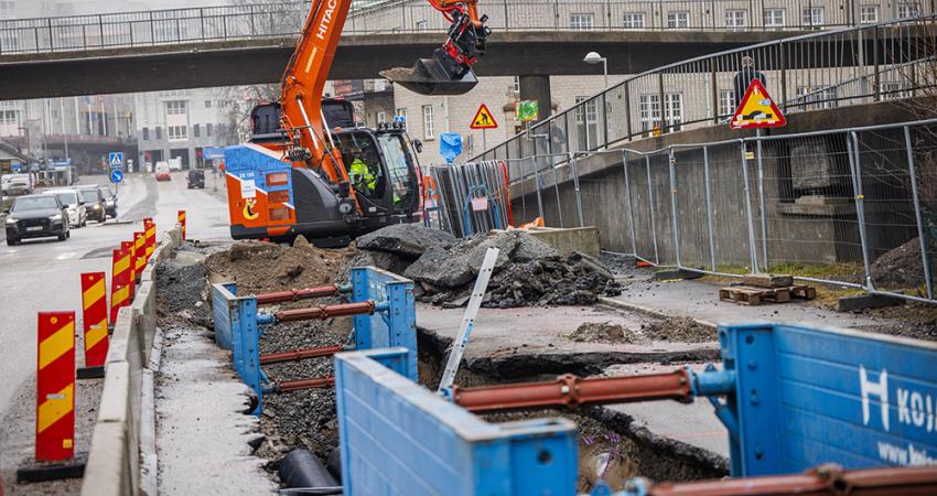
Seven years ago, the overpass collapse in Laval, Québec that led to the death of five people brought to light severe issues with the state of the country’s bridges and transportation infrastructure. More recently, a crack in the Champlain Bridge to Montreal that forced over 160,000 commuters to find alternate routes to work reaffirmed a need for greater emphasis on early detection before a crisis occurs.

Kevin Vine, MBA
Kevin Vine reports on the use of non-destructive testing for structural analysis of bridges
Seven years ago, the overpass collapse in Laval, Québec that led to the death of five people brought to light severe issues with the state of the country’s bridges and transportation infrastructure. More recently, a crack in the Champlain Bridge to Montreal that forced over 160,000 commuters to find alternate routes to work reaffirmed a need for greater emphasis on early detection before a crisis occurs.
Surprisingly, despite these concerns, regular inspection of transportation infrastructure is still not mandated in many areas. Furthermore, when inspection does occur, it is commonly carried out using traditional methods such as a visual inspection of structural elements followed by selective core sampling. These methods can be ineffective for a variety of reasons. Visual data is highly subjective and influenced by technician training and interpretation. Coring is often costly and fails to provide a quantifiable, representative sample of the entire inspection area.
In response to these challenges, municipalities and engineering firms across the country are beginning to incorporate non-destructive technologies into the inspection process to supplement traditional techniques. Combined with inspection data, project stakeholders are able to achieve a more substantive dataset on subsurface conditions and subsequently make more informed decisions around infrastructure rehabilitation spending and project prioritization.
Effectively planning a road or bridge rehabilitation program requires gathering and interpreting a considerable amount of data on a number of factors that may include asphalt, concrete and granular thickness; pavement or concrete damage; moisture in the concrete; rebar positioning and thickness, among others.
It can be difficult to achieve a representative sample of this data through traditional inspection techniques alone, such as cores or boreholes, because this approach often fails to capture a continuous profile of a stretch of road or bridge deck. For example, localised sampling may not account for variations in pavement layer thickness over a vast area that could have been caused by previous rehabilitation or maintenance.
However ground penetrating radar (GPR) is increasingly being used to close these information gaps and provide a more complete picture of infrastructure health. This non-destructive technology transmits high frequency radio waves into the ground or structure and analyses the reflected energy to create a profile of the subsurface features. The reflections are caused by a contrast in the electrical properties of subsurface materials which can be indicative of changes in water content, void spaces in the ground, rebar or post tension cable corrosion, asphalt deterioration and other factors.
Once collected, analysed and visualised, this data can then be used to make informed decisions around the design and execution of maintenance work for many different types of traffic infrastructure. It can also be used to better understand patterns of deterioration and the effectiveness of maintenance programs over time, reducing the risk of an unexpected failure.
“Non-destructive technology has the unique ability to detect deterioration and other subsurface anomalies before they develop into serious concerns,” said Dr Peter Annan, P.Eng, Ph.D Geophysics, Founder, Sensors & Software. “Techniques such as GPR, when applied to bridge deck deterioration assessment, reveal changes in subsurface properties that allow suspicious areas to be targeted for further evaluation and preventative remediation. More traditional methods such as chain drag, for example, will detect deterioration only once the concrete or bridge deck has already become cracked or delaminated.”
GPR was recently incorporated into a pavement investigation along a roadway just outside of Ottawa, Ontario. The project area contained active construction projects which made it difficult to coordinate field work. This impeded the ability to carry out the traditional inspection method which would typically involve conducting a visual inspection to identify distress, extracting pavement every 100-200m and then drilling boreholes to collect material from the roadway.
GPR was incorporated into the investigation to assess pavement structure interfaces while driving at posted speeds. Captured data, which was reported at 5m intervals, was analysed to identify asphalt thickness and granular layers. The data was then referenced using GPS coordinates.
“Leveraging GPR allowed us to continue the investigation while reducing conflict with ongoing construction,” said Mark Popik, senior pavement engineer, Thurber Engineering. “It supplemented the borehole information that we were able to collect, and provided a representative snapshot of conditions beneath the paved surface.”
The investigation resulted in a digital report that detailed the location, depth and thickness of asphalt and granular layers along the stretch of road.1224 Google Earth KMZ files were also provided so that the road could be visualized section by section along with corresponding pavement structure summary information.
“Often, when a stretch of road has recently been repaved, it may appear to be in good condition, but the subsurface conditions might be poor,” said Mark. GPR has the ability to detect areas where asphalt is unusually thin or thick and this information can then be correlated with observed road performance and factored into the construction design process.”
GPR was also applied to conduct a bridge deck inspection and deterioration analysis for sections of Toronto’s Gardiner Expressway: a major artery that runs 17.6km from the Don Valley Parkway to the Queen Elizabeth Way (QEW). In operation since 1955, structural concerns have prompted recommendations to rehabilitate and in some cases, replace raised sections of the Expressway.
To inspect the vast and geometrically complex structure, GPR was applied to analyse all continuous east and west bound lanes of a 15km raised section along with corresponding access ramps. High-resolution GPR observations were collected from curb to curb, less than a metre apart at a speed of 40km per hour. Six lines of data were captured for each vehicle lane and over 1.3 million targets within the project area were processed and georeferenced to assess deterioration. Data was then digitally recorded to produce colour-coded, contour maps for each section which were included with an evaluation report.
The data was also used to create a bridge deck deterioration index that indicated the percentages of each section that appeared to be above the deterioration threshold. Methodology prescribed by standard4814 ASTM D 6087–08 was leveraged and augmented by depth compensation to account for existing inconsistencies along the bridge deck. To ensure accuracy, data was also correlated with existing coring data and Ontario Structure Inspection Manual (OSIM) inspection records. With over 200,000 commuters relying on the Gardiner Expressway each day, this method made it possible to acquire data with no measureable impact on traffic flow.
“High-resolution GPR data is a key component of the inspection workflow,” said Dr. Annan. “When calibrated with coring and similar control data, a greater density of information is obtained, thus empowering more informed decisions around maintenance, rehabilitation and design. The ability to gather more information at the Outset greatly reduces the likeliness that plans will need to be re-thought at later stages of a project.”
With a majority of the country’s infrastructure reaching the 50 year mark and beyond, non-destructive geophysical techniques are becoming integral to ensuring the safety of roads and bridges. GPR offers a quick and cost-effective method for capturing high-resolution data that supplements information gathered through traditional techniques. It reveals anomalies deep below the surface and provides vital information to assist with key decisions around infrastructure rehabilitation.
With traffic gridlock costing the City of Toronto alone an estimated C$7-$11 billion/year, non-destructive inspection techniques allow municipalities and other project stakeholders to avoid or reduce closures, helping to alleviate further strain on Canada’s congested roads.
Kevin Vine, MBA
Kevin Vine is general manager of7807 multiVIEW Locates where he oversees a team of geoscientists, engineers and technical experts. Throughout his time with the company, he has led the successful execution of a number of major projects including non-destructive imaging for the Gardiner Expressway, subsurface mapping for the Union Station Rail Corridor Expansion, and many others.
Seven years ago, the overpass collapse in Laval, Québec that led to the death of five people brought to light severe issues with the state of the country’s bridges and transportation infrastructure. More recently, a crack in the Champlain Bridge to Montreal that forced over 160,000 commuters to find alternate routes to work reaffirmed a need for greater emphasis on early detection before a crisis occurs.
Surprisingly, despite these concerns, regular inspection of transportation infrastructure is still not mandated in many areas. Furthermore, when inspection does occur, it is commonly carried out using traditional methods such as a visual inspection of structural elements followed by selective core sampling. These methods can be ineffective for a variety of reasons. Visual data is highly subjective and influenced by technician training and interpretation. Coring is often costly and fails to provide a quantifiable, representative sample of the entire inspection area.
In response to these challenges, municipalities and engineering firms across the country are beginning to incorporate non-destructive technologies into the inspection process to supplement traditional techniques. Combined with inspection data, project stakeholders are able to achieve a more substantive dataset on subsurface conditions and subsequently make more informed decisions around infrastructure rehabilitation spending and project prioritization.
Effectively planning a road or bridge rehabilitation program requires gathering and interpreting a considerable amount of data on a number of factors that may include asphalt, concrete and granular thickness; pavement or concrete damage; moisture in the concrete; rebar positioning and thickness, among others.
It can be difficult to achieve a representative sample of this data through traditional inspection techniques alone, such as cores or boreholes, because this approach often fails to capture a continuous profile of a stretch of road or bridge deck. For example, localised sampling may not account for variations in pavement layer thickness over a vast area that could have been caused by previous rehabilitation or maintenance.
However ground penetrating radar (GPR) is increasingly being used to close these information gaps and provide a more complete picture of infrastructure health. This non-destructive technology transmits high frequency radio waves into the ground or structure and analyses the reflected energy to create a profile of the subsurface features. The reflections are caused by a contrast in the electrical properties of subsurface materials which can be indicative of changes in water content, void spaces in the ground, rebar or post tension cable corrosion, asphalt deterioration and other factors.
Once collected, analysed and visualised, this data can then be used to make informed decisions around the design and execution of maintenance work for many different types of traffic infrastructure. It can also be used to better understand patterns of deterioration and the effectiveness of maintenance programs over time, reducing the risk of an unexpected failure.
“Non-destructive technology has the unique ability to detect deterioration and other subsurface anomalies before they develop into serious concerns,” said Dr Peter Annan, P.Eng, Ph.D Geophysics, Founder, Sensors & Software. “Techniques such as GPR, when applied to bridge deck deterioration assessment, reveal changes in subsurface properties that allow suspicious areas to be targeted for further evaluation and preventative remediation. More traditional methods such as chain drag, for example, will detect deterioration only once the concrete or bridge deck has already become cracked or delaminated.”
GPR was recently incorporated into a pavement investigation along a roadway just outside of Ottawa, Ontario. The project area contained active construction projects which made it difficult to coordinate field work. This impeded the ability to carry out the traditional inspection method which would typically involve conducting a visual inspection to identify distress, extracting pavement every 100-200m and then drilling boreholes to collect material from the roadway.
GPR was incorporated into the investigation to assess pavement structure interfaces while driving at posted speeds. Captured data, which was reported at 5m intervals, was analysed to identify asphalt thickness and granular layers. The data was then referenced using GPS coordinates.
“Leveraging GPR allowed us to continue the investigation while reducing conflict with ongoing construction,” said Mark Popik, senior pavement engineer, Thurber Engineering. “It supplemented the borehole information that we were able to collect, and provided a representative snapshot of conditions beneath the paved surface.”
The investigation resulted in a digital report that detailed the location, depth and thickness of asphalt and granular layers along the stretch of road.
“Often, when a stretch of road has recently been repaved, it may appear to be in good condition, but the subsurface conditions might be poor,” said Mark. GPR has the ability to detect areas where asphalt is unusually thin or thick and this information can then be correlated with observed road performance and factored into the construction design process.”
GPR was also applied to conduct a bridge deck inspection and deterioration analysis for sections of Toronto’s Gardiner Expressway: a major artery that runs 17.6km from the Don Valley Parkway to the Queen Elizabeth Way (QEW). In operation since 1955, structural concerns have prompted recommendations to rehabilitate and in some cases, replace raised sections of the Expressway.
To inspect the vast and geometrically complex structure, GPR was applied to analyse all continuous east and west bound lanes of a 15km raised section along with corresponding access ramps. High-resolution GPR observations were collected from curb to curb, less than a metre apart at a speed of 40km per hour. Six lines of data were captured for each vehicle lane and over 1.3 million targets within the project area were processed and georeferenced to assess deterioration. Data was then digitally recorded to produce colour-coded, contour maps for each section which were included with an evaluation report.
The data was also used to create a bridge deck deterioration index that indicated the percentages of each section that appeared to be above the deterioration threshold. Methodology prescribed by standard
“High-resolution GPR data is a key component of the inspection workflow,” said Dr. Annan. “When calibrated with coring and similar control data, a greater density of information is obtained, thus empowering more informed decisions around maintenance, rehabilitation and design. The ability to gather more information at the Outset greatly reduces the likeliness that plans will need to be re-thought at later stages of a project.”
With a majority of the country’s infrastructure reaching the 50 year mark and beyond, non-destructive geophysical techniques are becoming integral to ensuring the safety of roads and bridges. GPR offers a quick and cost-effective method for capturing high-resolution data that supplements information gathered through traditional techniques. It reveals anomalies deep below the surface and provides vital information to assist with key decisions around infrastructure rehabilitation.
With traffic gridlock costing the City of Toronto alone an estimated C$7-$11 billion/year, non-destructive inspection techniques allow municipalities and other project stakeholders to avoid or reduce closures, helping to alleviate further strain on Canada’s congested roads.
Kevin Vine, MBA
Kevin Vine is general manager of