The Auckland Harbour Bridge is at the stage that it cannot cope with much more traffic, yet the population of the Auckland region continues to grow at a steady rate. Coupled with that, the bridge is a key link in the most important transport corridor in the country, State Highway One. Without it, the country would struggle to function. Not only home to New Zealand's largest city and one third of its population, Auckland's port is one of the country's largest. Some 140m north of the city is Marsden Point, th

New Zealand will benefit from major transport investment
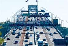
The Auckland Harbour Bridge is at the stage that it cannot cope with much more traffic, yet the population of the Auckland region continues to grow at a steady rate. Coupled with that, the bridge is a key link in the most important transport corridor in the country, State Highway One. Without it, the country would struggle to function.
Not only home to New Zealand's largest city and one third of its population, Auckland's port is one of the country's largest. Some 140m north of the city is Marsden Point, the country's only deepwater port. Consequently the harbour bridge is vital to getting goods from the north to the south and vice versa.
The original steel truss bridge is a very solid structure, with over 100 years of life left in it. The box girders, clipped on to add an extra four lanes to the bridge, have another 30-40 years until they will need to be replaced. They are currently undergoing strengthening to prolong their life, and, as part of this, heavy vehicles are no longer permitted to travel on them, and will possibly be barred once the strengthening is completed.
Even so, there is not much more capacity in the bridge for vehicles, there is no central pedestrian or cycle access across the harbour, and there is no rail to the North Shore suburbs either.
The1009 New Zealand Transport Agency (NZTA) is currently looking at another harbour crossing. The favoured option is a tunnel (actually four tunnels), two for road and two for rail.
The idea is that traffic bypassing the city - all that freight to South Auckland and the rest of the country - will use the tunnel, while the bridge will be used predominately by commuters heading into and out of the city. This lowered demand on the bridge will allow space to be allocated for cyclists and pedestrians.
The time to consent and construct the tunnels is estimated to take around 13 years and cost NZ$3 billion to $4 billion dollars (US$1.7-2.2 billion). With at least 30 years to undertake this project, time is still on the NZTA's side. However, at the moment it is busy working to protect the designated route - ensuring developments in the next decade or two will not impinge on the site.
There is currently a second harbour crossing on State Highway 18, the Upper Harbour Highway, to the northwest of the city, however State Highway 18 joins State Highway 16, the Northwestern Motorway, which promptly swings in and joins State Highway 1 in the heart of the city at what is know as Spaghetti Junction. Here, during peak hours, traffic is at a crawl.
This will be relief by the completion of the Western Ring Route (comprising SH18, part of SH16 and SH20 to the south). It splits from State Highway 1 12km north of the city, joining it again 20km to the south, allowing vehicles to bypass the city centre completely.
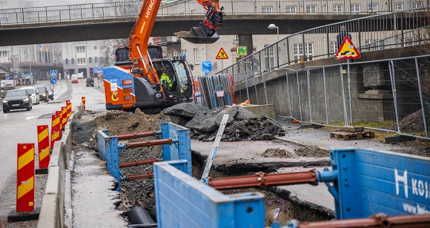
At this stage the Western Ring Route is largely finished, with four of the five final pieces currently under construction and due to be completed in time for the Rugby World Cup in October 2011.
However, as the Western Ring Route passes through the suburbs of Waterview and Mt Albert it reverts to suburban streets, complete with traffic lights, pedestrian crossings and a 50km/h speed limit. Because of this, freight trucks stick to State Highway 1 and commuter traffic on the Northwestern Motorway too often chooses to come onto State Highway 1, despite the congestion, when heading to the southern suburbs of the city.
This vital last piece, the Waterview Connection, is a hot political issue, with the last prime minister having her electorate in Mt Albert and promising her voters and neighbours that an above ground Waterview Connection would not happen. The problem is, the underground option is twice the price and limited to two lanes in each direction. But with a new government in place, things are likely to change. Whether an underground or overground option is chosen in the end, the Western Ring Route is on the cards to be completed soon, having recently been listed by the Minister of Transport as one of seven 'roads of national significance' and as such has been singled out for priority treatment.
When finished, Auckland's strategic route will be ladder shaped: The Western Ring Route and State Highway 1 making up the two sides, with a number of 'rungs' connecting them, allowing traffic to shift from one main route to the other if required by an accident or congestion.
Not only home to New Zealand's largest city and one third of its population, Auckland's port is one of the country's largest. Some 140m north of the city is Marsden Point, the country's only deepwater port. Consequently the harbour bridge is vital to getting goods from the north to the south and vice versa.
The original steel truss bridge is a very solid structure, with over 100 years of life left in it. The box girders, clipped on to add an extra four lanes to the bridge, have another 30-40 years until they will need to be replaced. They are currently undergoing strengthening to prolong their life, and, as part of this, heavy vehicles are no longer permitted to travel on them, and will possibly be barred once the strengthening is completed.
Even so, there is not much more capacity in the bridge for vehicles, there is no central pedestrian or cycle access across the harbour, and there is no rail to the North Shore suburbs either.
The
The idea is that traffic bypassing the city - all that freight to South Auckland and the rest of the country - will use the tunnel, while the bridge will be used predominately by commuters heading into and out of the city. This lowered demand on the bridge will allow space to be allocated for cyclists and pedestrians.
The time to consent and construct the tunnels is estimated to take around 13 years and cost NZ$3 billion to $4 billion dollars (US$1.7-2.2 billion). With at least 30 years to undertake this project, time is still on the NZTA's side. However, at the moment it is busy working to protect the designated route - ensuring developments in the next decade or two will not impinge on the site.
There is currently a second harbour crossing on State Highway 18, the Upper Harbour Highway, to the northwest of the city, however State Highway 18 joins State Highway 16, the Northwestern Motorway, which promptly swings in and joins State Highway 1 in the heart of the city at what is know as Spaghetti Junction. Here, during peak hours, traffic is at a crawl.
This will be relief by the completion of the Western Ring Route (comprising SH18, part of SH16 and SH20 to the south). It splits from State Highway 1 12km north of the city, joining it again 20km to the south, allowing vehicles to bypass the city centre completely.
At this stage the Western Ring Route is largely finished, with four of the five final pieces currently under construction and due to be completed in time for the Rugby World Cup in October 2011.
However, as the Western Ring Route passes through the suburbs of Waterview and Mt Albert it reverts to suburban streets, complete with traffic lights, pedestrian crossings and a 50km/h speed limit. Because of this, freight trucks stick to State Highway 1 and commuter traffic on the Northwestern Motorway too often chooses to come onto State Highway 1, despite the congestion, when heading to the southern suburbs of the city.
This vital last piece, the Waterview Connection, is a hot political issue, with the last prime minister having her electorate in Mt Albert and promising her voters and neighbours that an above ground Waterview Connection would not happen. The problem is, the underground option is twice the price and limited to two lanes in each direction. But with a new government in place, things are likely to change. Whether an underground or overground option is chosen in the end, the Western Ring Route is on the cards to be completed soon, having recently been listed by the Minister of Transport as one of seven 'roads of national significance' and as such has been singled out for priority treatment.
When finished, Auckland's strategic route will be ladder shaped: The Western Ring Route and State Highway 1 making up the two sides, with a number of 'rungs' connecting them, allowing traffic to shift from one main route to the other if required by an accident or congestion.
 and the old Northbound route")