Major road expansion is planned for Nepal, but will face huge challenges due to the country’s geography - Mike Woof reports, with local information from World Highways' Nepal correspondent, Ram Krishna Wagle
The tiny, landlocked nation of Nepal lies sandwiched between two of the world’s largest countries, China and India and maintains good relations with both. Politically Nepal has strong links with China, while culturally its ties are close with India and these relationships work both ways. Despite bein
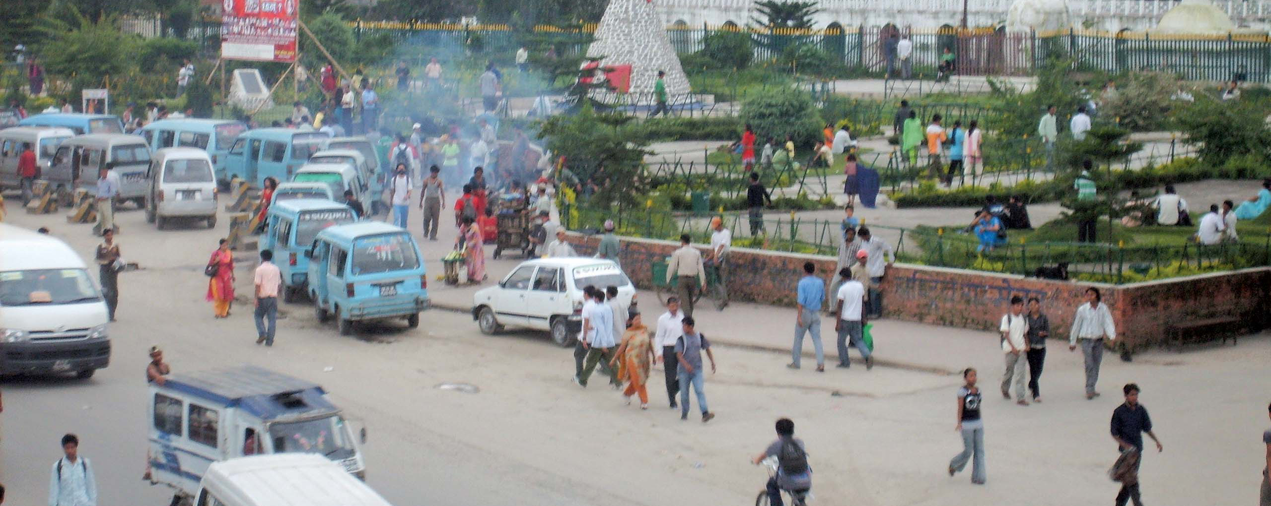
Kathmandu is a busy city with increasingly high traffic volumes – image courtesy of Ram Krishna Wagle
Major road expansion is planned for Nepal, but will face huge challenges due to the country’s geography - Mike Woof reports, with local information from World Highways' Nepal correspondent, Ram Krishna Wagle
The tiny, landlocked nation of Nepal lies sandwiched between two of the world’s largest countries, China and India and maintains good relations with both. Politically Nepal has strong links with China, while culturally its ties are close with India and these relationships work both ways. Despite being tiny in comparison, Nepal is an important trading partner for China and India and provides a vital transport connection across the continent for these much larger nations. Although Nepal’s recent political history has been tumultuous, with a series of changes in governments, the leaders of all the major parties have agreed upon the need for better transportation. And road transportation has been widely recognised as being crucial to the country’s development.
While Nepal is not strong economically, it is benefiting directly from its good relations with China and India in regard to infrastructure investment. And in spite of the changes of leadership in Nepal, these relations with China and India have been maintained. This is crucial as both of its giant neighbours have been providing economic assistance as well as technical expertise, input that is sorely needed. In addition Nepal also benefits from foreign aid provided by the EU, Japan, the Scandinavian nations, Switzerland, the UK and the US.
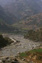
However Nepal’s geography poses a significant barrier for the country’s aim to improve transport. The Himalayan range lies in the north of the country, including eight of the world’s 10 highest mountains, and these present huge physical obstacles. In the southern lowland plains of the country, rivers descending from the mountains change course frequently, presenting another challenge. Meanwhile Nepal’s Hill Region includes altitudes ranging from 800-4,000m, itself providing difficulties for road builders. As a result of the technical issues resulting from the country’s geography as well as a shortage of construction machinery, building roads between cities, towns and villages in Nepal can be an expensive and almost painfully slow process.
Nepal’s road network is growing but there is an enormous need for more investment. A study in 2007 revealed that the country had 10,142km in all of surfaced roads and a further 7,140km of unsurfaced roads. Nepal has 75 District Headquarters and up to 15 have no direct connection by road, while 33% of the population live at least two hours walk from a road, presenting a major challenge to economic growth as well as for other factors such as education or health.
Because Nepal is landlocked, it relies on its transport links with China and India for trade and the nearest port is in Kolkata (Calcutta). But there is only one dependable road link between the Kathmandu Valley and India at present and the development of a new route will bring enormous economic benefits.
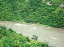
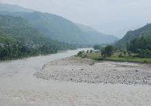
One issue that has affected a good deal of Nepal’s existing road infrastructure comes from the weather. Water flow rates can be enormous due to run-off from mountain glaciers, becoming worse still during the monsoon season due to intense bursts of heavy rainfall. Of the existing roads (surfaced and unsurfaced), up to 60% become unusable during the monsoon season and that includes most of the rural road connections.
Nepal’s geography means that bridges are crucial as the hilly and mountainous areas feature many deep gorges and rivers that have to be crossed. But these bridges suffer intense wear, both from the climate and from frequent vehicle overloading. Seasonal rainfall can subject bridges to enormous stresses, with many structures being damaged due to scour.
In a bid to improve the country’s bridges, Nepal’s Ministry for Physical Infrastructure and Transport inaugurated a programme of upgrades and maintenance work, with funding provided by the2332 World Bank. Grant assistance of US$148 million was provided by the World Bank for work on 26 new structures and 98 bridges requiring major maintenance. The programme also extended to 230 bridges requiring minor maintenance work and a further 95 needing light maintenance. “Connecting people with the road network can only develop a nation’s economy growth and prosperity,” commented Karla Gonzalez Carvajal, Sector Manager, Transport, South Asia Region, of the World Bank.
Of perhaps great priority still is the need to improve Nepal’s connections with its neighbours and the government has been pushing ahead with work on a series of major trade routes. The aim is to boost trade with neighbouring India and China and the programme will see four key trade routes being widened to six lanes, with three in either direction. These four routes are: Butwal-Belhiya; Rani-Ithari; Surybinayak-Dhulikhel; Birgunj-Pathalaiya highway sections. Meanwhile work is being carried out on a 15.4km stretch of the Suryabinayak- Dhulikhel road thanks to a loan from the Japanese Government. The work on the 28km stretch of the Birgunj-Pathlayia route is being carried out under the BOOT model. When the work is complete on these roads, journey times to India and China will be reduced, which will help to give the country’s economy a significant and much needed boost, and its agricultural industry will find new markets in these neighbouring nations.
Since Nepal embarked on its road construction programme, the Ministry of Physical Planning works and Transport Management said that the country has so far built 25,115km of roads, of which 11,565km is dirt road, 6,077km is gravel road and 7,474km is asphalt paved road. Statistics from the Ministry of Physical Planning, Works and Transport Management showed that 1,180km of new roads were constructed in Nepal in the 2011-2012 fiscal year alone. The statistics revealed that of the 1,180km of roads (short of the 1,280km target), 290km were surfaced with asphalt and 407km were gravel roads, while there were also 47 new bridges built in the period.
Arguably the most significant project underway in Nepal at present is for the 58km highway connecting Kathmandu with Kulekhani and Hetauda and which includes the construction of three new road tunnel sections. The Kathmandu - Kulekhani - Hetauda route is being carried out as a build-operate-transfer (BOT) project, the first tolled highway in Nepal being built under this model since the necessary legislation was drafted. The Kathmandu - Kulekhani - Hetauda Tunnel (KKHT) Highway is being designed with two lanes in either direction as well as a median strip. It will be operated under a 30-year concession signed with the Nepal Government, with an option to extend the deal by a further five years.
The three, four-lane tunnels, measure 3,425m, 735m and 392m in length and total 4.5km. The longest stretch of tunnel is being built from Kulekhani to Bhimfedi, with the 735m tunnel being constructed at Bhainse and the 392m tunnel being driven at Chobar. The project developer is Nepal Purbadhar Bikash (NPBCL) while the prime consultant for the project is the Full Bright Consultancy. NPBCL says it is the first public limited company in Nepal that has been established to build a national toll highway to Asian Highway Standards.
The highway is expected to cost some $375 million and will reduce the journey time between Hetauda in Makawanpur and Balkhu in Kathmandu from six to eight hours at present, to just one hour. Once the new route is open in December 2016, it is also expected to improve traffic safety as the existing routes feature a number of dangerous stretches. The highway will provide a much shorter route out of the Kathmandu Valley and its construction will provide better transport links between the west of the country to the south and east. This key transport route is expected to make a significant boost to economic development along the corridor in particular, and in Nepal as a whole in general. The existing 227km route from Hetauda-Narayanghat-Mugling-Kathmandu carries the heaviest traffic of any route in the country, providing an important trade route to India. One alternative route is the 133km Tribhuvan Highway, but this is not suited to high speed transport and the journey takes seven to eight hours. While there are other shorter routes these are in poor condition and are not suited to high speed transport.
The5283 Nepalese Government is working on plans to build a series of highways that will improve north-south connectivity. The new Karnali road will link Khulalu, Simikot and Hilsa and will be 286km long. The first phase of the Kaligandaki highway will link Gaindakot, Mirmi, Balubang and Phalebas in Parbat and will be 283km long, while its second phase will link Kusma, Phalebas, Setibeni and Mirmi and will be 98km long. The Koshi Corridor highway will pass through Basantapur in Terathum to Kimanthanka and will measure 195km long. In all, the planned roads measure some 1,350km long but the various routes present major engineering challenges due to Nepal’s altitude and complex geological conditions.
Nepal has established a new framework to help boost the efficiency of its transportation plans and investments. Key road sections in the Kathmandu valley will be widened, Putalisadak-Kamalpokhari, Kamalpokhari-Ratopul, Lainchour-Sorhakhute, Maitighar-Banewshwore, Naghpokhari-Balaju bypass, Naxal-Narayanchour, Dillibazzar-Baluwatar-Maharajgunj.
Another key project for the country is the Kathmandu-Nijgadh-Pathlaiya Terai/Madesh Expressway project, also being built under the PPP model. The 76km expressway is expected to cost $853 million to construct and it will feature 84 bridges, of which 22 will have spans of 30-50m and seven will span 115m. The road will be tolled, with the concaession running until 2035. @@@ But a major problem for Kathmandu in general is that the current road infrastructure in the city is not sufficient for the increasing numbers of vehicles. In a bid to tackle the problem, the authorities initiated a programme of road widening to reduce traffic jams, especially during peak hours. The2719 Chinese Government has provided Nepal with expertise and funding for the ring road development around capital Kathmandu. The programme is for the widening of 27km of the ring road from its present four lanes to eight lanes in all. The road is being upgraded in three separate phases, with the first stage being the 9km Kalanki-Koteshowre section and the building of a new interchange.
The growth in vehicle numbers has been significant. In 1992 there were just 48,188 registered vehicles in the Kathmandu Valley and the total length of the road network in the area was 1,595km. There are now 567,670 registered in the Kathmandu Valley. And it is worth noting that this figure does not include other vehicles registered elsewhere in the country travelling through the valley, or vehicles entering the country from neighbouring China or India. According to Nepal’s Metropolitan Traffic Division, there are now around 800,000 vehicles in the valley overall.
Agriculture accounts for 35% of Nepal’s GDP and this sector also employs around 75% of the country’s workforce. Transporting goods to market is crucial for economic development, particularly with regard to trade with China and India. Improved road links will cut transport times and costs and boost the economic benefits of trade with the neighbouring countries for Nepal’s producers.
Air travel is well-developed and Nepal has 47 airports, 11 of which have proper surfaced runways. However Nepal’s air safety record is not good due to many of the airports being located at high altitudes where weather conditions can be subject to rapid change. The country has airport facilities noted to be amongst the highest and most challenging for pilots, while aircraft condition is not always optimal and crashes are not infrequent.
The Nepalese Government has carried out a comprehensive survey of road transportation. This has been the first time in the country’s history that such a survey has been undertaken, with Nepal’s Central Bureau of Statistics gathering data to help government fiscal planning, public transportation and also help in education and research.
Nepal's2437 Ministry of Physical Planning and Works, Nepal has carried out extensive traffic improvement studies for the Kathmandu valley, with assistance from the 2416 Japan International Cooperation Agency (JICA). 2664 Nepal's Department of Roads is using traffic data based on research work into congestion carried out by consultants.
Being small, landlocked and mountainous, poverty is a major issue in Nepal. But despite its small economy, Nepal’s progress on reducing poverty has been highly effective and continues. However unemployment levels remain high and many citizens currently leave the country to find employment elsewhere around the world. Australia, Canada, India, Japan, Saudi Arabia, Thailand and the UK are amongst the key countries where Nepalese move to find work. Nepalese soldiers are highly regarded for their bravery and in a curious historical anomaly, also fight for both the British and Indian armies in special Gurkha battalions. This is also of key economic importance, contributing nearly 23% of Nepal’s GDP.
Nepal has to import fuel for power generation and transportation from China and India as the country does not have any deposits of gas or coal of its own. Despite the fact that Nepal’s hilly and mountainous areas feature many fast flowing rivers, hydroelectricity accounts for only 40% of the country’s power generation at present. The country has around 20 hydroelectric plants (as well as some smaller facilities) at the moment, generating some 600MW. A further nine hydroelectric plants are being built, with 27 having been identified for future development. But some estimates suggest that the country has the potential to produce a total of 44,000MW from 66 sites in all. This is a key issue as Nepal has a shortage of electrical power at present, particularly in rural areas. Only 40% of Nepal’s population overall have access to electricity and the vast majority of those properties connected to the grid are in the major urban areas. The electricity supply is also unreliable at present with long power cuts common, particularly in wintertime when demand is highest, while costs to consumers are high and the system is also said to be highly inefficient.
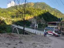
The construction of two particular bridges is improving access to remote areas, as well as to an important power generation facility. The Arun River Bridge at Leguwaghat in Dhankuta, and the Sabha Khola Bridge in Sankhuwasabha District are of major significance. The Arun River Bridge provides a key link to access a network of 162km of roads, while the Sabha Khola Bridge connects with Sankhuwasabha District and is also important for the Arun III hydroelectric project.
UK consultant IMC Worldwide carried out the engineering design report and suggested that the most appropriate bridge layouts would be single 120m-span through-truss decks with 6m wide carriageways, and featuring a 1m raised footpath on one side. The bridges have semi-circular, steel trusses, with in-situ reinforced concrete deck slabs on reinforced concrete cantilever abutments and wing walls. The structures have a design life of 100 years, with the Sabha Khola Bridge built on rock and well foundations up to 16m deep for the Arun Bridge at Leguwa. The foundations have been protected against scour to maximise longevity.
The tiny, landlocked nation of Nepal lies sandwiched between two of the world’s largest countries, China and India and maintains good relations with both. Politically Nepal has strong links with China, while culturally its ties are close with India and these relationships work both ways. Despite being tiny in comparison, Nepal is an important trading partner for China and India and provides a vital transport connection across the continent for these much larger nations. Although Nepal’s recent political history has been tumultuous, with a series of changes in governments, the leaders of all the major parties have agreed upon the need for better transportation. And road transportation has been widely recognised as being crucial to the country’s development.
While Nepal is not strong economically, it is benefiting directly from its good relations with China and India in regard to infrastructure investment. And in spite of the changes of leadership in Nepal, these relations with China and India have been maintained. This is crucial as both of its giant neighbours have been providing economic assistance as well as technical expertise, input that is sorely needed. In addition Nepal also benefits from foreign aid provided by the EU, Japan, the Scandinavian nations, Switzerland, the UK and the US.
However Nepal’s geography poses a significant barrier for the country’s aim to improve transport. The Himalayan range lies in the north of the country, including eight of the world’s 10 highest mountains, and these present huge physical obstacles. In the southern lowland plains of the country, rivers descending from the mountains change course frequently, presenting another challenge. Meanwhile Nepal’s Hill Region includes altitudes ranging from 800-4,000m, itself providing difficulties for road builders. As a result of the technical issues resulting from the country’s geography as well as a shortage of construction machinery, building roads between cities, towns and villages in Nepal can be an expensive and almost painfully slow process.
Nepal’s road network is growing but there is an enormous need for more investment. A study in 2007 revealed that the country had 10,142km in all of surfaced roads and a further 7,140km of unsurfaced roads. Nepal has 75 District Headquarters and up to 15 have no direct connection by road, while 33% of the population live at least two hours walk from a road, presenting a major challenge to economic growth as well as for other factors such as education or health.
Because Nepal is landlocked, it relies on its transport links with China and India for trade and the nearest port is in Kolkata (Calcutta). But there is only one dependable road link between the Kathmandu Valley and India at present and the development of a new route will bring enormous economic benefits.
One issue that has affected a good deal of Nepal’s existing road infrastructure comes from the weather. Water flow rates can be enormous due to run-off from mountain glaciers, becoming worse still during the monsoon season due to intense bursts of heavy rainfall. Of the existing roads (surfaced and unsurfaced), up to 60% become unusable during the monsoon season and that includes most of the rural road connections.
Nepal’s geography means that bridges are crucial as the hilly and mountainous areas feature many deep gorges and rivers that have to be crossed. But these bridges suffer intense wear, both from the climate and from frequent vehicle overloading. Seasonal rainfall can subject bridges to enormous stresses, with many structures being damaged due to scour.
In a bid to improve the country’s bridges, Nepal’s Ministry for Physical Infrastructure and Transport inaugurated a programme of upgrades and maintenance work, with funding provided by the
Of perhaps great priority still is the need to improve Nepal’s connections with its neighbours and the government has been pushing ahead with work on a series of major trade routes. The aim is to boost trade with neighbouring India and China and the programme will see four key trade routes being widened to six lanes, with three in either direction. These four routes are: Butwal-Belhiya; Rani-Ithari; Surybinayak-Dhulikhel; Birgunj-Pathalaiya highway sections. Meanwhile work is being carried out on a 15.4km stretch of the Suryabinayak- Dhulikhel road thanks to a loan from the Japanese Government. The work on the 28km stretch of the Birgunj-Pathlayia route is being carried out under the BOOT model. When the work is complete on these roads, journey times to India and China will be reduced, which will help to give the country’s economy a significant and much needed boost, and its agricultural industry will find new markets in these neighbouring nations.
Since Nepal embarked on its road construction programme, the Ministry of Physical Planning works and Transport Management said that the country has so far built 25,115km of roads, of which 11,565km is dirt road, 6,077km is gravel road and 7,474km is asphalt paved road. Statistics from the Ministry of Physical Planning, Works and Transport Management showed that 1,180km of new roads were constructed in Nepal in the 2011-2012 fiscal year alone. The statistics revealed that of the 1,180km of roads (short of the 1,280km target), 290km were surfaced with asphalt and 407km were gravel roads, while there were also 47 new bridges built in the period.
Arguably the most significant project underway in Nepal at present is for the 58km highway connecting Kathmandu with Kulekhani and Hetauda and which includes the construction of three new road tunnel sections. The Kathmandu - Kulekhani - Hetauda route is being carried out as a build-operate-transfer (BOT) project, the first tolled highway in Nepal being built under this model since the necessary legislation was drafted. The Kathmandu - Kulekhani - Hetauda Tunnel (KKHT) Highway is being designed with two lanes in either direction as well as a median strip. It will be operated under a 30-year concession signed with the Nepal Government, with an option to extend the deal by a further five years.
The three, four-lane tunnels, measure 3,425m, 735m and 392m in length and total 4.5km. The longest stretch of tunnel is being built from Kulekhani to Bhimfedi, with the 735m tunnel being constructed at Bhainse and the 392m tunnel being driven at Chobar. The project developer is Nepal Purbadhar Bikash (NPBCL) while the prime consultant for the project is the Full Bright Consultancy. NPBCL says it is the first public limited company in Nepal that has been established to build a national toll highway to Asian Highway Standards.
The highway is expected to cost some $375 million and will reduce the journey time between Hetauda in Makawanpur and Balkhu in Kathmandu from six to eight hours at present, to just one hour. Once the new route is open in December 2016, it is also expected to improve traffic safety as the existing routes feature a number of dangerous stretches. The highway will provide a much shorter route out of the Kathmandu Valley and its construction will provide better transport links between the west of the country to the south and east. This key transport route is expected to make a significant boost to economic development along the corridor in particular, and in Nepal as a whole in general. The existing 227km route from Hetauda-Narayanghat-Mugling-Kathmandu carries the heaviest traffic of any route in the country, providing an important trade route to India. One alternative route is the 133km Tribhuvan Highway, but this is not suited to high speed transport and the journey takes seven to eight hours. While there are other shorter routes these are in poor condition and are not suited to high speed transport.
The
Nepal has established a new framework to help boost the efficiency of its transportation plans and investments. Key road sections in the Kathmandu valley will be widened, Putalisadak-Kamalpokhari, Kamalpokhari-Ratopul, Lainchour-Sorhakhute, Maitighar-Banewshwore, Naghpokhari-Balaju bypass, Naxal-Narayanchour, Dillibazzar-Baluwatar-Maharajgunj.
Another key project for the country is the Kathmandu-Nijgadh-Pathlaiya Terai/Madesh Expressway project, also being built under the PPP model. The 76km expressway is expected to cost $853 million to construct and it will feature 84 bridges, of which 22 will have spans of 30-50m and seven will span 115m. The road will be tolled, with the concaession running until 2035. @@@ But a major problem for Kathmandu in general is that the current road infrastructure in the city is not sufficient for the increasing numbers of vehicles. In a bid to tackle the problem, the authorities initiated a programme of road widening to reduce traffic jams, especially during peak hours. The
The growth in vehicle numbers has been significant. In 1992 there were just 48,188 registered vehicles in the Kathmandu Valley and the total length of the road network in the area was 1,595km. There are now 567,670 registered in the Kathmandu Valley. And it is worth noting that this figure does not include other vehicles registered elsewhere in the country travelling through the valley, or vehicles entering the country from neighbouring China or India. According to Nepal’s Metropolitan Traffic Division, there are now around 800,000 vehicles in the valley overall.
Agriculture accounts for 35% of Nepal’s GDP and this sector also employs around 75% of the country’s workforce. Transporting goods to market is crucial for economic development, particularly with regard to trade with China and India. Improved road links will cut transport times and costs and boost the economic benefits of trade with the neighbouring countries for Nepal’s producers.
Air travel is well-developed and Nepal has 47 airports, 11 of which have proper surfaced runways. However Nepal’s air safety record is not good due to many of the airports being located at high altitudes where weather conditions can be subject to rapid change. The country has airport facilities noted to be amongst the highest and most challenging for pilots, while aircraft condition is not always optimal and crashes are not infrequent.
The Nepalese Government has carried out a comprehensive survey of road transportation. This has been the first time in the country’s history that such a survey has been undertaken, with Nepal’s Central Bureau of Statistics gathering data to help government fiscal planning, public transportation and also help in education and research.
Nepal's
Being small, landlocked and mountainous, poverty is a major issue in Nepal. But despite its small economy, Nepal’s progress on reducing poverty has been highly effective and continues. However unemployment levels remain high and many citizens currently leave the country to find employment elsewhere around the world. Australia, Canada, India, Japan, Saudi Arabia, Thailand and the UK are amongst the key countries where Nepalese move to find work. Nepalese soldiers are highly regarded for their bravery and in a curious historical anomaly, also fight for both the British and Indian armies in special Gurkha battalions. This is also of key economic importance, contributing nearly 23% of Nepal’s GDP.
Nepal has to import fuel for power generation and transportation from China and India as the country does not have any deposits of gas or coal of its own. Despite the fact that Nepal’s hilly and mountainous areas feature many fast flowing rivers, hydroelectricity accounts for only 40% of the country’s power generation at present. The country has around 20 hydroelectric plants (as well as some smaller facilities) at the moment, generating some 600MW. A further nine hydroelectric plants are being built, with 27 having been identified for future development. But some estimates suggest that the country has the potential to produce a total of 44,000MW from 66 sites in all. This is a key issue as Nepal has a shortage of electrical power at present, particularly in rural areas. Only 40% of Nepal’s population overall have access to electricity and the vast majority of those properties connected to the grid are in the major urban areas. The electricity supply is also unreliable at present with long power cuts common, particularly in wintertime when demand is highest, while costs to consumers are high and the system is also said to be highly inefficient.
The construction of two particular bridges is improving access to remote areas, as well as to an important power generation facility. The Arun River Bridge at Leguwaghat in Dhankuta, and the Sabha Khola Bridge in Sankhuwasabha District are of major significance. The Arun River Bridge provides a key link to access a network of 162km of roads, while the Sabha Khola Bridge connects with Sankhuwasabha District and is also important for the Arun III hydroelectric project.
UK consultant IMC Worldwide carried out the engineering design report and suggested that the most appropriate bridge layouts would be single 120m-span through-truss decks with 6m wide carriageways, and featuring a 1m raised footpath on one side. The bridges have semi-circular, steel trusses, with in-situ reinforced concrete deck slabs on reinforced concrete cantilever abutments and wing walls. The structures have a design life of 100 years, with the Sabha Khola Bridge built on rock and well foundations up to 16m deep for the Arun Bridge at Leguwa. The foundations have been protected against scour to maximise longevity.

