The emphasis on data processing and re-use, continues to grow in the development of design and management software. The interoperability of software, the need to handle and process larger amounts of data, and re-use and retention of data sets from one task to another have been a growing emphasis in the past few years. It allows infrastructure companies to get better value from expensively collected information and to focus more on the whole life cycle of projects.
AutoDesk's Civil 3D is a major civil engineering design tool
The emphasis on data processing and re-use, continues to grow in the development of design and management software
The interoperability of software, the need to handle and process larger amounts of data, and re-use and retention of data sets from one task to another have been a growing emphasis in the past few years. It allows infrastructure companies to get better value from expensively collected information and to focus more on the whole life cycle of projects.Helping achieve this, the major software suppliers particularly, like
They also help coordinate and re-use data gathered for survey and analysis, the design process, and construction, including for visualisations for client presentation and public consultation, and then on-site scheduling and management. Beyond that the aim is to extend data use into the later stages of projects including the operations and maintenance phases.
But a first priority is simply to handle the ever growing amounts of data which are being produced. One advance in that area is the advent of the 64bit computer, the next step up after the 32bit processing that has been the norm for the last decade and a half.
Most processor units at the heart of the PC have been able to work at the 64bit level for some years, which means they throughput the raw data for calculations in larger chunks. Equally importantly it allows far more memory addresses to be used since the basic binary reference is much longer. The 4GB limit on immediate access RAM memory is already lifted to 10-12GB and will be virtually limitless in the future.
But the computer operating systems, and particularly the almost universal Microsoft Windows have been slower to catch up for a variety of reasons, including the need for peripherals and components, like scanners and plotters, to have 64bit driver software as well. Now the recent launch of the Windows 7 operating system, in both 32 and 64bit versions, which is proving much more popular than its immediate predecessor Windows Vista, sees 64bit coming into its own. "I think it is probably the fastest take up of an operating system I have seen" said Patrick McGloin of the Norwegian Novapoint software house.
Novapoint's modular road design system, built on the basic AutoCAD program, is to be released in a 64bit version this summer, and its completely reworked version 19, which is due to appear in the autumn will be pure 64bit said McGloin.
The new version is a rebuild of the whole package which will allow a seamless linking together of the various modules from the basic road alignment tools to drainage, signing, lampposts and other specific modules like tunnel design. At present some of these can be accessed directly from the core tools but others require data export and import. In particular the 3D visualisation tool which gives an engineering level of accuracy for a visual representation of all of the design layers together, for construction management, clash detection, and examining line of sight for signs and so forth, will be accessible directly.
AutoDesk itself is already there, emphasising in its launch of the 2011 suite of software design tools in late March that it is Windows 7 and 64bit capable. That runs across the board, from the basic core but increasingly sophisticated AutoCAD 2D and 3D drafting program itself, to its civil engineering design tool Civil 3D road.
Other packages also used in conjunction with road design work, like the 'intelligent' Revit building and structure design program are also in 64bit and so too the other major applications that make up the wide portfolio. AutoDesk's 3DS Max Design program, usually accepted as the most wide ranging and flexible of visualisation programs, used by most major consultancies and firms for public consultation, animations, and client presentations, already benefits from 64bit for rendering images. It also has the capacity to use multicore processors to speed up the number crunching for images by processing chunks of information in parallel.
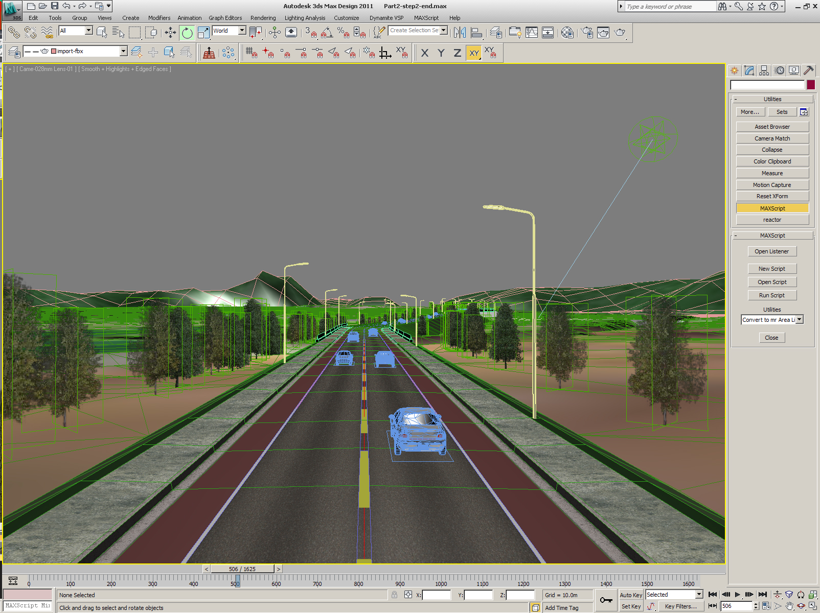
Connecting into this to produce high quality images and "animated" movies of road designs has been made easier in recent years by the Dynamite program from 3am software, which provides a bridge between the design model data in Civil 3D and the 3DS Design environment.
Dynamite provides an intermediate interface tailored specifically for road projects, with its own templates of elements which can be easily placed to allow civil engineers easily to build up the otherwise complex models needed to make professional looking visualisation.
This program and an extension to connect traffic simulation programs like German transport software specialist PTV's Vissim, to provide "real" moving traffic images, have recently been purchased by AutoDesk and renamed Civil Visualisation Extension will be supplied as a bonus subscription download for holders of the 3DS Max Design software "giving you a fairly expensive program for no extra cost" said Jack Strongitharm, the UK Civil 3D applications engineer at Autodesk. Like AutoDesk's whole suite, the programs all come with a uniform user interface based on the AutoDesk version. Civil 3D itself, also with the common interface, has a number of new features in the 2011 version. It now has a dynamic link between super-elevation and geometry for example, so that that component updates on the fly like most of the other "intelligent object" elements used to build a design from a basic road alignment. One of the strongest features of the digital model type of program is that all the elements of a design are linked and "self-adjusting" as design changes are made.
New functions released as downloadable extensions for Civil 3D subscribers, (World Highways software supplement 2010) have now been incorporated into the 2011 version. These included point cloud handling, a roundabout design wizard, a best fit tools for alignment and profiles, and a sight-line distance analysis tool.
An automatic best fit alignment and profile tool to create a smoothed fit to survey data such as a road centreline is in the toolbox.
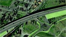
A significant addition is a new roundabout tool which uses a point and click selection of alignments and position combined with a "wizard" to set the parameters for the new roundabout. A local standards file helps set the parameters to place the roundabout to standards and also provide deflection to prevent a "bad" design with wrong approach angles for example. The tool works in 2D to produce a plan view instantly, leaving the engineer to then complete the 3D profile and corridor design.
Finally a new surface analysis tool calculates line of sight along the road. Users can set driver eye height and object heights and the tool will display the sightlines along the road which are visible from any position as 3D green lines with a red line continuation if surfaces interfere.
Making full use of 64bit capabilities in most of the programs including Civil 3D, will be a new capacity to draw in point clouds from laser scans. The huge data sets, from static tripod mounted scanners, mobile vehicle scanners and airborne LidAR, can handle hundreds of millions or even billions of separate points. These will be displayed as shadowy images behind the main design, much as raster photographs are drawn in and used, but in three dimensions. "They contain much greater detail than simple survey line and point information" said Strongitharm "and reveal deformations in road surfaces and the like.
Just how these information clouds will be used now that they can be imported alongside other data and design information is partly still to be determined. One producer of this kind of data, Dr Graham Hunter, managing director of
Recognising the potential AutoDesk has included a new API for third parties to make use of pointcloud functionality for development of new plug-ins and capacities for AutoDesk programs. The import tools are also versatile, recognising data formats from most of the companies producing laser surveying equipment such as
It is a big question to understand what engineers will eventually be able to do with the clouds and how they will fit into tradition methods of survey and model building.
But the cloud data already has a wide range of uses for local authorities and transportation departments. Hunter's company produces data using vehicle-mounted lasers for 360º high precision mapping to a range of 300m. It also makes and sells the vehicles for use by other companies worldwide, in conjunction with German guidance and navigation specialist IGI and Austrian technology company Riegl.
The vehicles which have several lasers on board, and synchronised video cameras can take 300,000 measurements/second/sensor. Claimed accuracies are achievable to less than 10mm though only when surveys are carried out using ground control stations placed every 400m or so.
There is a growing use of the clouds says Hunter, "and we find that for many purposes the mobile scan can compete with traditional survey as well as static based laser."
A major advantage he said, is that data is collected on the move without needing to temporarily cone, or fence off, highways while traditional surveying teams are at work.
Both Bentley and Novapoint also can import this kind of data. At Novapoint Patrick McGloin says that the software has handled clouds of up to about 250M points for four years and that lidar data from helicopters is very commonly used to built up a basic digital terrain model for Norwegian road schemes.
Bentley Systems is just now adding point cloud handling capability to its wide range of engineering design and GIS portfolio, following the announcement last year that it is licensing the Vortex "engine" from UK company
A beta version for the MicroStation 2D and 3D drawing program is due shortly said Joe Croser, Bentley's global marketing director for platform products, "which will mean it will be available for all the tools built on top of that, like the road design tools such as Inroads, and MX."
Pointools software is widely acknowledged to be the fastest available and with additional capacities to store other information about cloud point colour and density. Bentley says it evaluated all the options for embeddable point cloud handling and found this engine to be two to five times faster at handling the huge amounts of data.
Bentley is also gradually moving over to 64bit applications and is working on a version for MicroStation though it may not introduce that for a while. Its programs are currently compatible with Windows 7 and the ProjectWise collaboration server system.
Croser argued that although 64bit allows much bigger files to be stored, a key constraint on engineers is the capacity to move data about from office to office. Current communication, even broadband, still means it is better to break up information into smaller packages.
The range of applications has increased rapidly with purchases in recent years of high end software such as the advanced Austrian bridge analysis tool RM Tools, now more and more integrated into the package of road design and other bridge analysis tools that Bentley provides for its Bridge Information Modelling concept, which it sees as "facilitating the flow of digital information between planning, design, engineering, analysis, fabrication, construction, maintenance, and rehabilitation. Development includes new drawing production tools which originate in the purchase last year of Chinese software from Bridgemaster; the purchase also links the Bentley family of bridge tools into the Chinese market.
New wizards for the complex RM Tools are in production currently to allow a simplified development of either smaller bridges, which do not require the full power of RM Tools.
But the biggest development of Bentley's across-the-board concept whole life tools for engineers is its purchase of
Exor's system ties into
Alongside the Exor Bentley has bought


