Construction of the new coastal highway on Reunion Island is continuing, despite tough engineering challenges. Located in the Indian Ocean to the east of Madagascar and some 175km to the south-west of Mauritius, Reunion Island is one of four overseas departments of France.
Despite being thousands of km from France, it is part of the country (and the EU) legally. Because of this situation, the responsibility for infrastructure development on the island lies with the French Government, which is why France has stepped in to build the new highway; La Nouvelle Route du Littoral. This challenging project is now being carried out by a French consortium including
Measuring 63km long by 45km wide, the island has a population of around 845,000 (according to the 2014 survey) and covers an areas of over 2,500km2. The island is located on a hotspot for volcanic activity, with large eruptions having occurred most recently in April 2007 and September 2016. The island features two large volcanoes, the extinct Piton des Neiges which rises to a height of 3,070m and the active Piton de la Fournaise, which is 2,631m high and lies at the eastern end of the island. The 2007 eruption of the latter resulted in a lava flow estimated at around 3,000,000m3/day at its peak, which was a major cause for concern and this volcano is monitored constantly as a result.
Because of its volcanic origins the island’s terrain as well as its geology are challenging in many places and it is these factors that have given need to the construction of the new road link. The slopes of the two volcanoes, active and extinct, are tree covered and most of the habitation, economic activity and agronomy for the island’s population is on the lowland area around the coastline, which is also where the capital, Saint-Denis, lies. The road connections heading westwards from Saint-Denis towards Saint-Paul have not been able to keep pace with traffic demand however, restricting trade and transport, including the island’s crucial tourism sector.
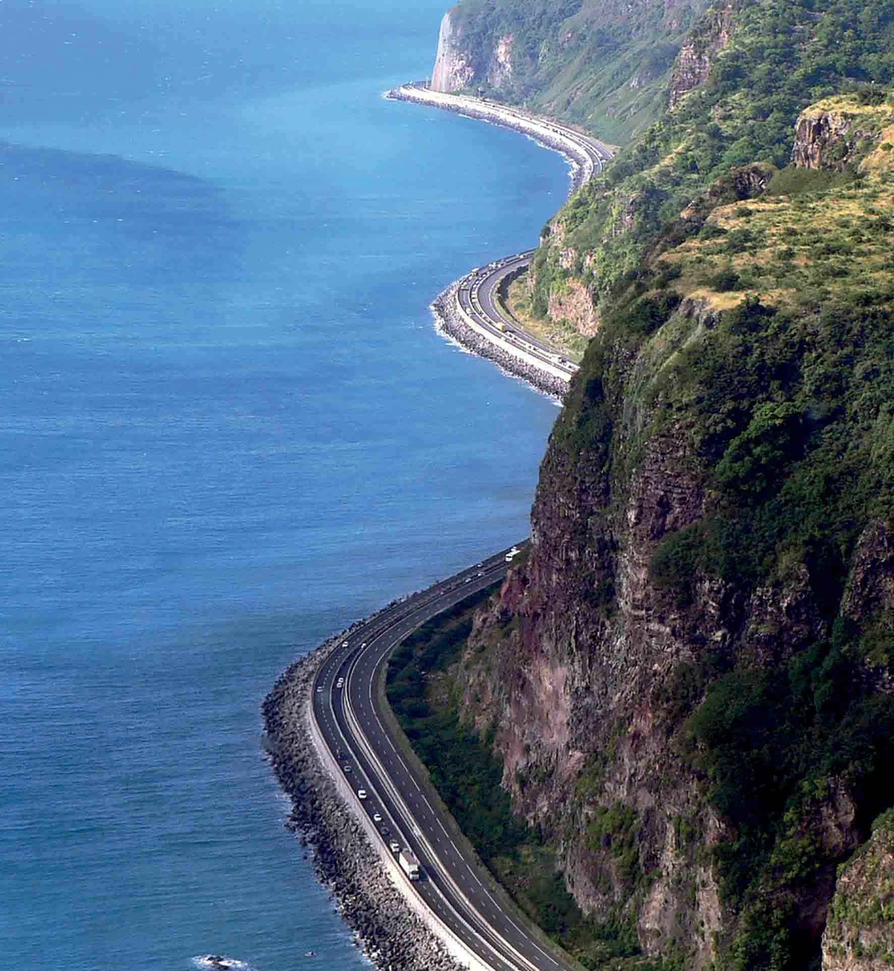
The inland route running west from Saint-Denis is narrow and twisty and is totally unsuited to heavy vehicles or high traffic volumes due to safety issues. The old Route One Nationale coast road meanwhile has just two lanes in either direction and along its most treacherous particular stretch, the road hugs the cliff side. As a result of this steep terrain, as well as the island’s geology, this section of the road is prone to being blocked by rockslides.
During stormy weather also the route can be made impassable due to heavy seas. These issues have forced the frequent closures of the old coastal road, with traffic on the route being halted around 40times/year on average.
This route carries very heavy traffic volumes between the island’s main port of Pointe des Galets in the north-west of the island and the capital Saint-Denis, as well as its adjacent Roland Garros International Airport.
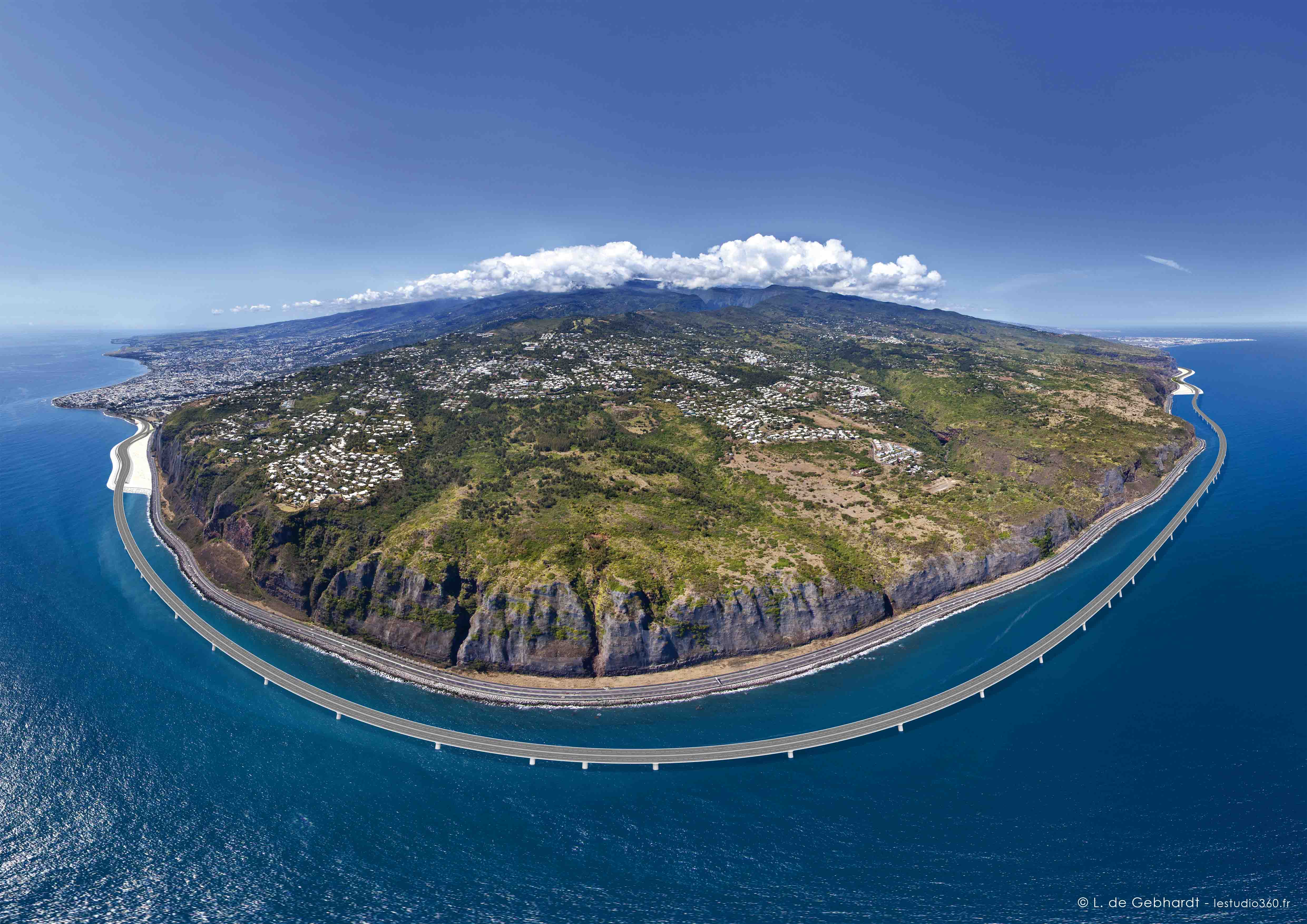
But with the island’s population growing, particularly in its northern end, the limitations and concerns over the coast road were seen to be putting a brake on development of the area. As a result of its capacity limits and heavy congestion, the delays to transport and lengthy traffic diversions caused by rockfalls and storms as well as in terms of safety, it was abundantly clear that a better link was much-needed. The most visually impressive portion of the new highway project is the 5.4km-long viaduct that runs around the coast of the island.
Set away from the cliff, this viaduct has been designed to avoid the problems with dangerous rock-falls that have plagued the existing road, resulting in blockages to traffic as well as the need for repairs.
The project has not been without its detractors however. The construction of the 12.5km route is costly due to the complex nature of the work, with the 5.4km causeway stretch being particularly expensive. The early predictions for the cost of around €1.3 billion fell somewhat short and in all the project is now coming with a price-tag of around €1.7 billion. At a cost of around €13,600/m of road, the project has understandably been criticised for its expense. There have been questions as to whether the road could have been constructed more cheaply, particularly at a time when France, like other countries, has had to cope with restrictions on its government spending. Moreover, the project has also faced criticism on environmental grounds due to the delicate ecological balance on the island.
Surrounded by coral reefs along much of its coastline, questions were raised when the project was announced as to the environmental impact of the construction work. And the announcement that the project would go ahead came despite opposition from various environmental groups, including the National Council for the Protection of Nature (CNPN).
The viaduct is being built with three lanes in either direction and will include separate provision for buses, cyclists and pedestrians.
Because of the tropical climate of the region, the road is also being built to cope with wave heights of up to 10m as well as hurricanes featuring wind-speeds as high as 144km/h.
To optimise the operation the viaduct is being built in precast sections on land. The viaduct will have a total of 36 main piers and a supporting structure comprising 1,386 precast segments. The precast components are being transported out to sea to allow installation on the columns supported by piled footings.
Work on this portion of the project has been aided by the use of the world’s largest offshore overhead travel crane; a floating construction platform complete with a huge crane. This is being used to anchor the piers on the seabed by lifting the prefabricated foundation elements and placing these in position.
The highly specialised piece of equipment was developed and manufactured by
Lifting and lowering is carried out using a reeved winch system, based on eight grooved drum winches. For longitudinal travelling, the gantry features a trolley arrangement that has two trolleys for each lifting beam. Each of the trolleys is powered by hydraulic motors that drive through planetary gearboxes. The wheels run on two parallel rails bolted onto the barge’s runway beams. Side shifting of the gantry hoists is driven by long stroke cylinders in a continuous movement.
As the OHTC is key to the operation, the project team ensured that the machine would be able to handle the task in hand, so testing was first carried out on one of the pairs of beams. This included lifting large blocks, synchronised lifting of these blocks with a hook from each beam, and checking the crane’s positioning, lifting and lowering to an accuracy of 1mm.
Meanwhile for transporting the main piers and the viaduct segments on land, the construction consortium is using three split combination PST/SL 18 (P1+1/2) heavy-duty modules supplied by
These units were selected for two main reasons according to Goldhofer. Its split combination design enables the width of the decks of the modules to be increased by 50%.
This makes the transporters wide enough to take the 36 main piers, which weigh 700tonnes each, as well as being narrow enough for the limits on overall vehicle width. Another relevant detail is the fact that the chosen combinations are self-propelled, heavy-duty modules. These have hydrostatic drives with two 365kW PowerPacks. The vehicles require this power to travel at the speeds required. As the operation has required several months of work, the vehicles were fitted with fully enclosed cabs.
The main piers are transported over a distance of around 1km from the concrete plant to the port, where they are loaded onto the floating platform to be taken to the construction site. The 1,386 viaduct segments, each weighing between 210 and 285tonnes, are taken straight out to the viaduct.
Transport operations are carried out during night-time hours as there is much less traffic.
Two of the four lanes can then be closed, and the heavy-duty transporters carrying the viaduct segments can use the closed lanes to travel a distance of around 15km from the concrete plant to the finished length of viaduct. At the end of the last completed deck section, the precast segments are picked up using the specialised launching gantry and are then lowered into place. According to the construction schedule, 1,386 journeys are to be made over a three-year period for the viaduct segments alone.
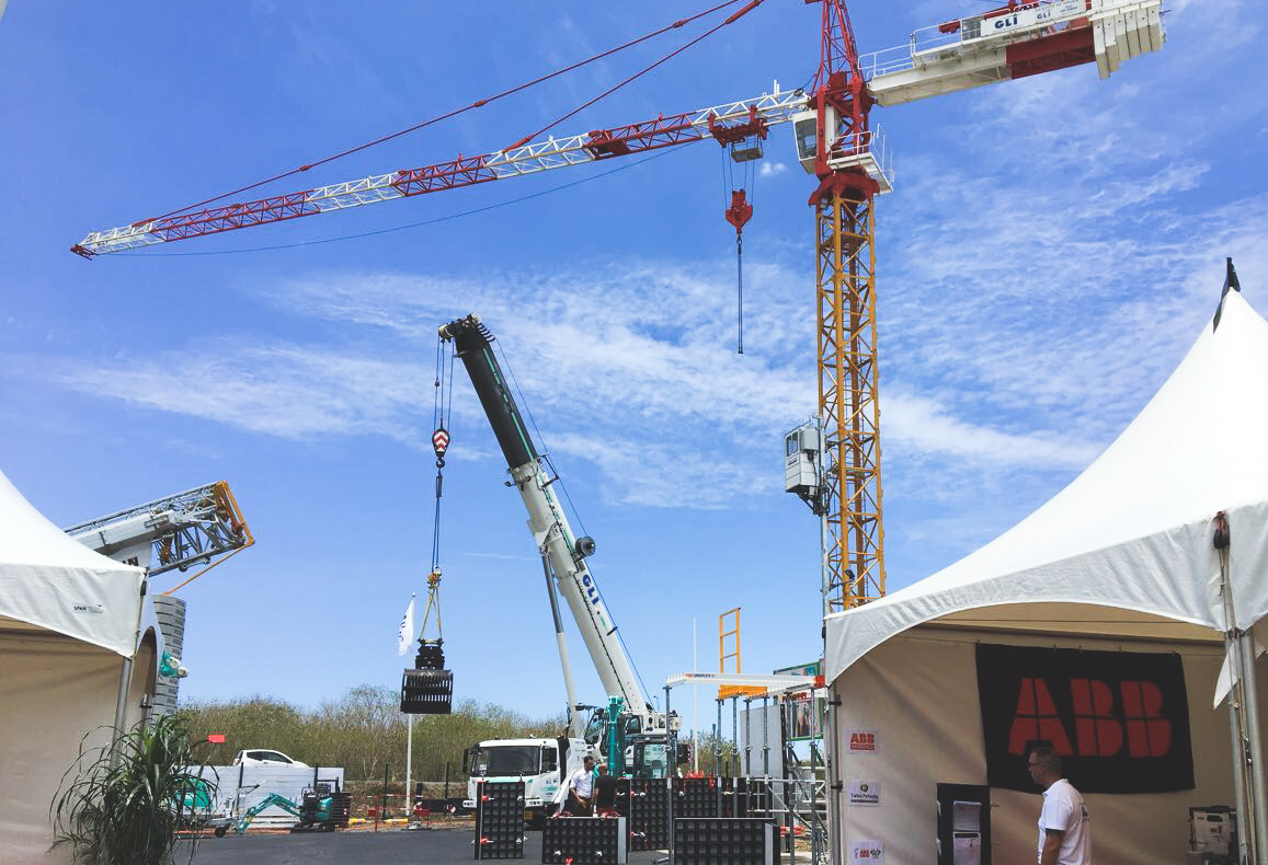
Because of the scale of the operation it has required the use of an extensive fleet of conventional heavy lifting equipment also. A total of 16 cranes from
The remaining units came from Grues Levages Investissements (GLI), which has provided cranes on a rental basis. GLI is the official Manitowoc dealer for Reunion Island (as well as Mayotte and Mauritius).
In addition to the construction activity the project includes substantial measures to limit its environmental impact. Other aspects of the work include overall design, providing geotechnical support along the route, and planning for its geometry and traffic management, as well as for the finished road. Because there is a shortage of sand and aggregate on the island for the work, the materials are having to be imported, further complicating the construction operations.
This has presented an additional logistical challenge, although the engineering team has been careful to optimise the process and avoid the risk of delays caused by supplies slowing the construction work. Supplier Comarco won a contract to provide the necessary aggregates for the project from its operation on Madagascar. To handle materials transport the firm assigned two barges, the Comarco 3651 and Comarco 3652, and two tugs, the 2,982kW Raptor and the 2,535kW Bateleur, to handle the work. The first 8,000tonnes of rock was delivered by Comarco 3651, with a steady stream of regular rock supplies then following by sea afterwards.
Island road development
This is not the first major road project for Reunion Island in recent times, as work on the Route des Tamarins commenced in 2003 and was completed in 2009. Costing €1 billion, the Route des Tamarins features two lanes in either direction and connects Saint-Paul and L'Etang-Salé through Saint-Denis in the north of the island with Saint-Pierre in the south. A portion of the funding required, some €200 million, came in the shape of a loan from the European Investment Bank. But this was itself a highly ambitious project and the complexity of the construction work saw the costs balloon from the €700 million price-tag that was originally envisaged.
The high cost of building this road also stemmed from the tough terrain encountered, due much to the island’s volcanic nature, as the route had to pass over 120 gullies in all. The Route des Tamarins features four large viaduct sections, 23 bridges and three tunnel stretches. There are also nine interchanges located at Saint-Paul, Plateau Caillou, the Eperon, the Hermitage, the Dam, the Colimaçons, Stella, Portal, and L'Etang-Salé, all of which further added to the project’s complexity and overall cost.
However the work was deemed necessary to help with the island’s economic development, particularly with regard to boosting its tourism industry. Building the Route des Tamarins has helped cut congestion in the island’s urban areas, while allowing better transport overall, particularly to the western side. The construction of the highway from Saint-Paul to L'Etang-Salé was carried out in two main phases. Key contractor for the section from Saint-Paul to the RD10 portion of the project was DDE while work on the RD10 stretch at Salt Lake was carried out by Scetauroute.


