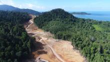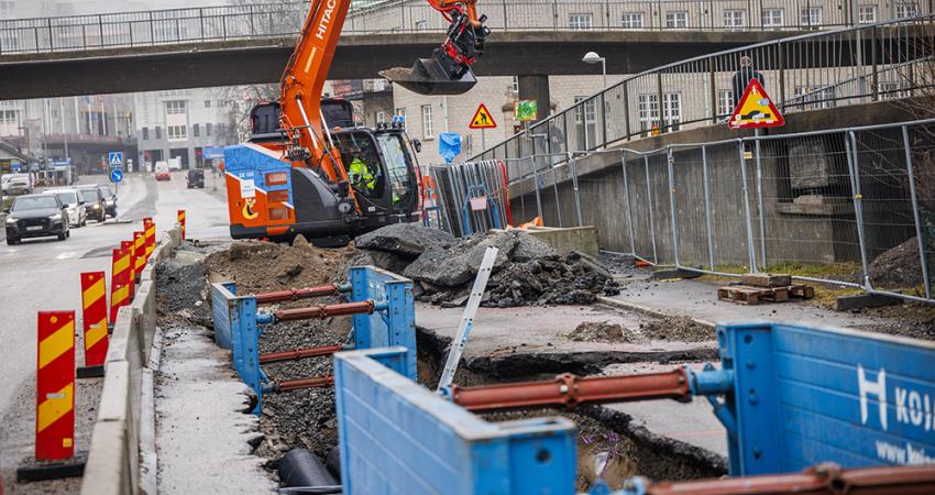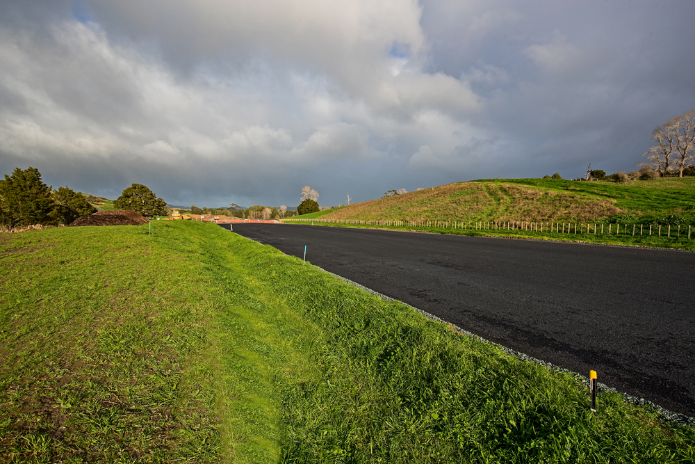
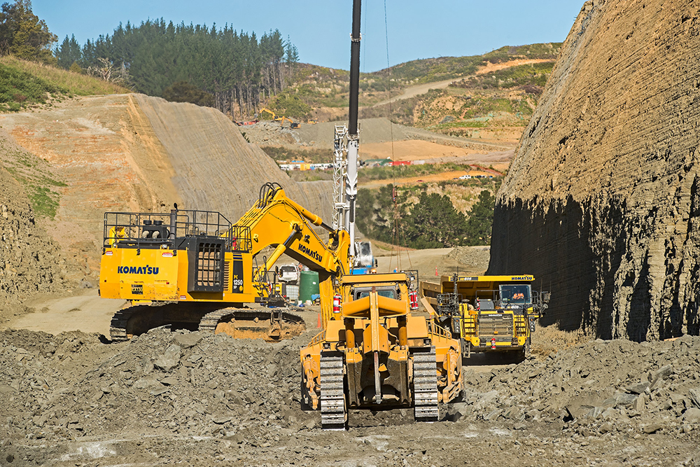
For contractors on New Zealand's Pu¯hoi-to-Warkworth motorway project, October 1 marks the official start of the summer earthmoving season. After the COVID-19 lockdown disrupted last summer’s work season, contractors are hoping for long days of uninterrupted sunshine and little or no rain. That’s the perfect mix for moving mountains of rock and dirt. So far, 8.2 million m3 of cut and fill have been shifted, leaving more than one million m3 to be moved.
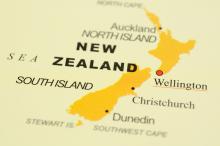
The next six months will see the fourth major earthworks season on the project, just north of Auckland, New Zealand’s biggest city with a population of around 1.5 million people.
When Prime Minister Jacinda Ardern called for New Zealand’s entire population to go into Alert Level 4 lockdown in March, it shut down all the country’s construction sites with just two days’ notice. It couldn’t have come at a worse time for the Pu¯hoi-to-Warkworth project, with the earthmoving season in full swing. But the health and safety of New Zealand and the workforce was the priority.
When work resumed, it was in a different world of strict health and safety protocols and cooler, wetter, winter weather. Waka Kotahi negotiated a new opening date with NX2, Northern Express Group: mid-May 2022 – five months later than originally scheduled.
The cost of COVID
NX2 in turn contracted a joint venture of Fletcher/ and Acciona to build the motorway. The new agreement included a payment of $85 million (US$56.5 million) to the contractors to cover the cost of delays and other impacts resulting from the five-week COVID-19 shutdown. Similar payments were made to other contractors across the country whose projects were affected by lockdowns.
A further $83 million (US$55.1 million), which had been agreed prior to COVID-19, was also paid out. This was to cover extra costs and delays to work at the northern end of the project caused by land purchases taking longer than expected and appeals to the Environment Court. The extra payments are in addition to the project’s present contract price of $709.5 million (US$471.2 million).
As with all projects, the new completion date is heavily dependent on good weather and no additional disruption such as another lockdown. However, in mid-August, a new COVID-19 outbreak saw the Auckland region, including the Pu¯hoi-to-Warkworth project area, go back into Alert Level 3 precautions and the rest of the country into Alert Level 2 for two weeks.
However, with more than 500 workers on-site, construction continues under strict health and safety protocols. That includes working in so-called bubbles to limit contact between teams, restricted access to site, contact tracing and requirements for workers to increase hygiene measures, maintain physical distancing and use additional personal protective equipment and clothing.
When it opens, the Pu¯hoi-to-Warkworth motorway will extend the four-lane Northern Motorway (SH1) another 18.5km to the north of Auckland city. Its will run from the Johnstone’s Hill tunnels, just south of Pu¯hoi, to a major roundabout just past the fast-growing town of Warkworth, where the highway also branches off to Wellsford further north.
The new motorway is being built to the west of the existing SH1, a narrow road of a single lane in each direction and winding through undulating hills. On average, around 20,000 vehicles a day travel the SH1 between Pu¯hoi, 50km north of Auckland and on the banks of the Pu¯hoi River, to Warkworth, around 64km north of Auckland. Within the next decade traffic is predicted to increase to more than 31,000 vehicles a day, shared between the new motorway and the current SH1.
The old route has a high crash rate and the new motorway will provide increased safety, more consistent travel times and create a more resilient road between Auckland and Northland. It will also provide a better freight connection between Northland and the Upper North Island.
When new motorways are built or significantly upgraded in New Zealand, they are considered for tolling as a way of paying for construction and maintenance. If the new motorway is tolled, the existing SH1 will be maintained as a free alternative route and there is a proposal to reduce speed limits on this road to improve safety. But it won’t be before the road opens in May 2022 that a decision is reached on whether to make Pu¯hoi-to-Warkworth the nation’s fourth tolled motorway.
Safe and scenic
The safety philosophy behind the design of the new motorway is to keep traffic moving at a constant speed rather than speeding up and slowing down over different parts of the motorway. The absence of long straights and wide curves is designed to discourage drivers from reaching high speeds. Also, there will be a central median with a wire rope barrier to prevent head-on collisions.
At Moir Hill, an extra lane for slow vehicles will be provided to the left of the two lanes. Design features will force traffic to slow at the northern end of the motorway as vehicles head into the slower-speed environments of Warkworth and the existing state highway network.Even with slower speeds, trucks are expected to save time due to reductions in grades and a better road layout to help heavy vehicles maintain a higher average speed.
People using the motorway will have a truly scenic trip as it passes through hilly areas, native forest, bush and wetlands. The motorway will follow a curved route without long straights. It will follow the natural contours of the land as much as possible with the road surface kept to a steady gradient.
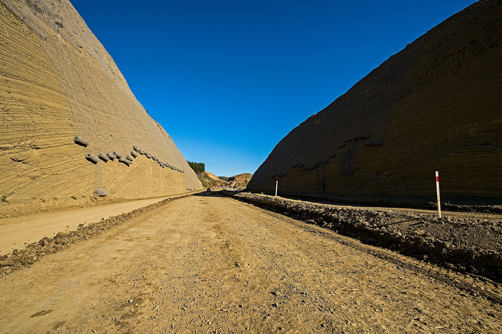
That means the road will travel through - rather than over - forested areas and there are spectacular cuts through hillsides of Pakiri sedimentary rock that create solid rock walls up to 50m high.
Millions of cubic metres of rock and soil cut or soil excavated from the hilly landscape have been moved to fill the gullies and build up the road level.
More than 5 million m3 of cut material will be used as fill. Another 2 million m3 of material not suitable as fill will be moved to soil disposal sites within the project area. Some of this material, including topsoil, will be used for reshaping and landscaping the surrounding areas of the new motorway.
The project alignment has been divided into four zones, with different amounts of earthworks in each zone. The central north zone has the most earthworks to complete, due to the steep hills and deep gullies in the forestry area. The zones are designed to reduce as much as possible the mass haul of cut material to fill areas.
The steep rock cuts showcase the geology of the area as a key feature of the journey. To catch loose and falling debris, a fixed drapery wire mesh will cover many rock faces but it will still allow the natural features of the rock to be visible. The height of the mesh will be fixed at 4.7m above the carriageway to avoid any distractions for road users.
Viaducts
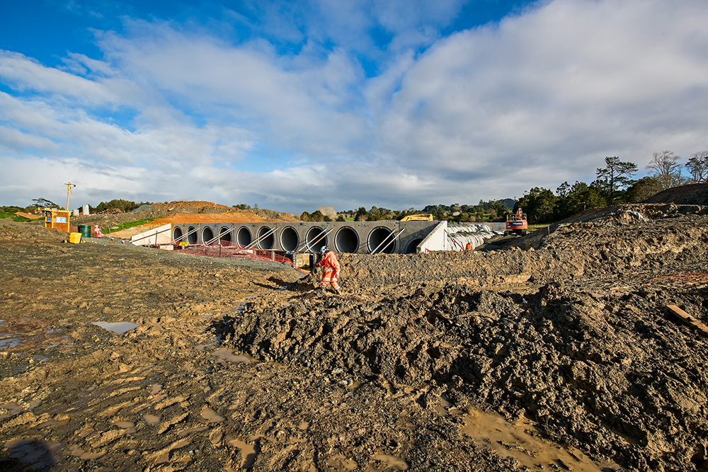
There are 46 culverts along the alignment, including an 11-barrel culvert structure for flood relief at Carran Road. This will be the largest culvert in New Zealand.
In all, there are 187 concrete pipes, each weighing 10tonnes. When complete, each barrel will be 42m long and 2.4m in diameter. The culvert allows floodwaters from the Mahurangi Stream to pass under the motorway to a flood plain.
Elsewhere on the alignment there are seven bridges and viaducts over flood plains or significant streams to allow natural water flows to be maintained.
The largest of these are the Arawhiti ki O¯kahu (O¯kahu Viaduct) and Arawhiti ki Pu¯hoi (Pu¯hoi Viaduct). The names were gifted by the project’s indigenous Maori partners, the Ho¯kai Nuku who have historic and territorial rights over the land. The viaduct names are to acknowledge the significance of the landscape to Ho¯kai Nuku.
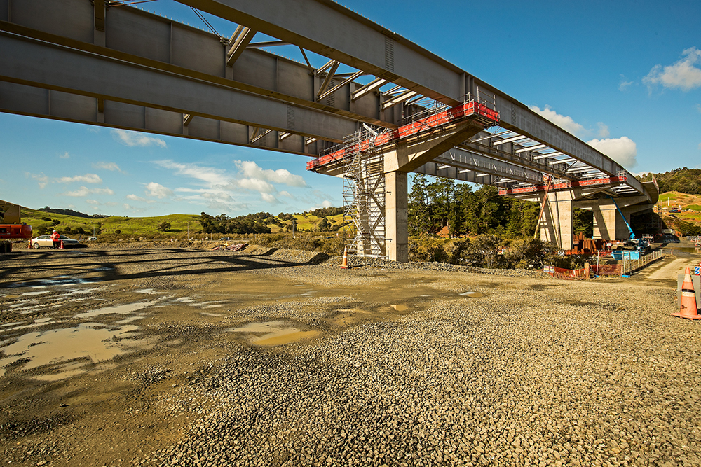
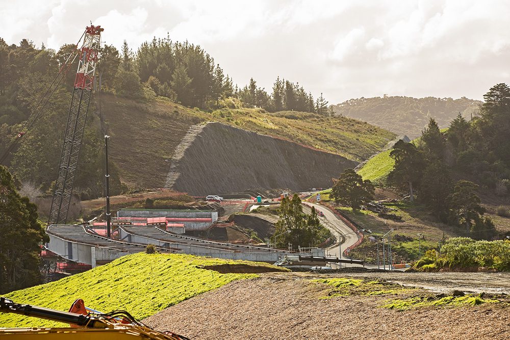
The viaducts are of symmetrical-span steel girder design. Arawhiti ki O¯kahu is the longest, measuring 330m and 25m wide, while the nearby Arawhiti ki Pu¯hoi is 316m long and 27.5m wide.
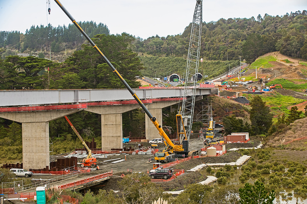
The viaducts are at different stages of construction. In August, bridge girders and deck panels were installed on Arawhiti ki Pu¯hoi. The steel girders weighing 50tonnes each are constructed 450km away in Napier and trucked to site. The girders – 52 in all – are being lifted into place four at a time by crawler cranes.
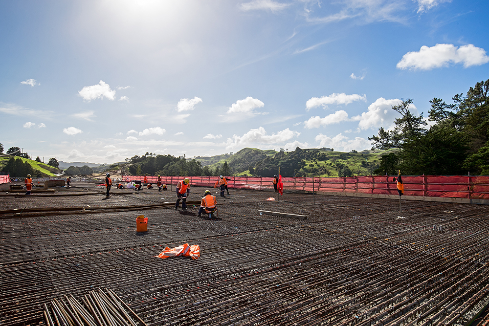
Girders were installed on Arawhiti ki O¯kahu in July, with concrete poured on the bridge deck in August. The pour took place in six stages, with the first and largest pour completed over a 12-hour period. In that time, about 313m³ of concrete was poured over a 65m section of the viaduct.
Another key structure on the motorway is the Arawhiti Pua Ngahere (Kauri Eco Viaduct). This 75m-long, 27m-wide three-span bridge will take the motorway over the Mahurangi River and Kauri forest. The superstructure consists of precast concrete super-T beams on 900mm-diameter columns. The viaduct was designed to minimise the impact on an important forest of native Kauri trees. It will provide a magnificent sight of the Kauri for motorists travelling over the viaduct.
Road surfacing works are already under way at both ends of the project. Around 149,150 tonnes of asphalt will be laid along the 18.5km motorway alignment. To be as efficient as possible, the project is establishing its own asphalt plant during the winter months so asphalt is ready to be delivered in quantity for the coming summer season.
The final surface will be covered with open grade porous asphalt (OGPA), often used on New Zealand highways where higher traffic volumes occur. The higher ratio of air voids than traditional asphalt helps water runoff and absorbs road noise. This also increases skid resistance, enhancing safety for the travelling public. Paving the asphalt in one uniform width will enhance its quality and longevity, as well as optimise production.
Winter months
One winter activity in full swing now is the planting of vegetation to replace native vegetation lost during earthworks. Such planting is carried out in New Zealand’s winter months, from May to September, when the ground is wet and plants are largely dormant. This allows the vegetation to acclimatise to a new environment before the summer season when plant growth accelerates.
COVID-19 slowed the start of the winter planting programme so it will continue in the 2021 season. A team of 18 people are planting about 9,000 plants a day, depending on the terrain, access and weather.
About half of the one million plants, most of them native species, are now in place. The planting success ratio of 10-gain to 1-lost is one of the highest ratios for any New Zealand road project. Planting is spread across forests, wetlands, alongside steams, on fill sites and in newly landscaped areas.
Amenity plants – often referred to as ornamental trees – are being installed on the cuts and fills to visually enhance the surrounding area and provide screening of the new motorway. Wetland planting – providing an environmental function in the stormwater wetlands and ecological mitigation planting – will offset the native vegetation removed as part of the project works.
Restoration of native species is an important - and popular - conservation activity in New Zealand. It also contributes to the project’s achievement of the Greenroads standard, an international sustainability certification system (see box).
To achieve Greenroads, the project has to meet 12 requirements. Points are earned for delivering sustainable outcomes such as habitat conservation, work zone health and safety, recycled and recovered content and multimodal connectivity. Certification normally occurs after the project opens. NX2 is aiming for the project to achieve a Greenroads Silver Rating, the standard set by the client Waka Kotahi.
Work is already underway to connect the motorway to the current state highway network. Construction of the roundabout that will connect the new motorway to State Highway 1 at the northern end is particularly well advanced.
A new 1.4km road – Matakana Link Road – is also under construction as an Auckland Transport project to carry traffic from the motorway to the east coast beaches and settlements at Leigh, Omaha, Sandspit and Snells Beach. It is expected to be completed in time for the motorway opening in May 2022 .
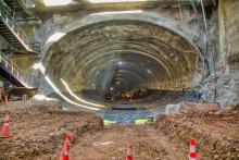
At the southern end of the motorway, significant work is underway near the Johnstone’s Hill tunnels. The new motorway will begin about 50m on from the Pu¯hoi side of the tunnels. But motorists will barely have time to notice as the motorway sweeps out on to the spectacular Arawhiti ki O¯kahu – the O¯kahu Viaduct. Before any traffic ventures on to the viaduct, however, there needs to be significant changes to widen the SH1 layout and connect it to the new motorway. This is an exciting stage of construction because at both ends of the project it is being worked out how the new motorway will connect to the existing state highway. The new alignment has been under construction over the last couple of years alongside SH1, and both will now be brought together.
The Johnstone’s Hill tunnel area can be a traffic bottleneck, especially at weekends or on public holidays, as the two-lane northbound tunnel currently operates only one lane.
There will be significant traffic flow improvements once the road is widened with the addition of new lanes to create a seamless four-lane connection between the tunnels and the new motorway. The end result will be a world-class motorway providing a safer, more robust and reliable transport corridor connecting Northland to Auckland and the rest of New Zealand.
Waka Kotahi, the New Zealand Transport Agency, will own the motorway as a public asset.
NX2, the private sector consortium Northern Express Group, is working within a public-private partnership to finance, design, build, maintain and operate the motorway for up to 25 years.
NX2’s equity investors are NZ Accident Compensation and Public Infrastructure Partners II, Spanish infrastructure group Acciona Concesiones and Fletcher Building, one of Australia’s largest building materials manufacturer and distributer.
In turn, NX2 has contracted the design and construction to a joint venture of Acciona Infrastructure Australia and Fletcher Construction, owned by Fletcher Building.
An asset management and maintenance joint venture has been set up between Higgins Contractors, a New Zealand civil construction business that designs and builds major infrastructure projects, and Acciona Concesiones.
The Ara Tūhono Partnership consists of the New Zealand Transport Agency, NX2 and Hōkai Nuku (www.hokainuku.co.nz), an alliance of four groups of indigenous New Zealand peoples whose traditional lands encompass the motorway route. Hōkai Nuku provides advice and collaborates on cultural, social, environmental and economic aspects of the project. The relationship between the transport agency and Hōkai Nuku as Treaty Partners has been formalised in a relationship agreement.
Project subcontractors include:
- Design sub-consultants - Beca, Tonkin and Taylor
- Earthworks – Goodmans; Ford Civil
- Blasting – Redbull
- Piling for structures - CLL Service Solutions
- Earthworks/paving – Wharehine
- Steelwork - Eastbridge
- Cranes – Smith Cranes; NZ Cranes
- Quality control – Geotechnics
- Earthworks/crushing - Waiau Pa Crushing
Concrete precasts - Wilson Precast
- Northern zone, the 11-barrel culvert
- Arawhiti ki Pūhoi (Pūhoi Viaduct) with Johnstone’s Hill tunnels behind
- Arawhiti ki Pūhoi looking north
- Girder lift at the Arawhiti ki Pūhoi (Pūhoi Viaduct)
- Excavation at the central north cut
- Wire mesh is draped over walls of central north zone cuts
Greenroads Standard
Established in 2010, Greenroads Foundation is a US-based independent non-profit corporation which advances sustainability education and initiatives for transportation infrastructure. The Greenroads foundation manages the certification process for sustainable transportation development projects in the US and internationally. The rating system credits are divided into five core categories: environment and water; construction activities; materials and design; utilities and controls; and access and livability.
The bigger picture
The Pūhoi-to-Warkworth motorway project is part of the greater Ara Tu¯hono – Pūhoi to Wellsford Road of National Significance which runs about 38km north of Auckland through the Rodney area. The project aims to extend the Northern Motorway (State Highway 1 / SH1) from the Johnstone’s Hill tunnels just south of Pūhoi to a point north of Wellsford.

